Sunday, May 27, 2012

Lava Beds National Monument, near Tulelake, CA.

Today we visited Lava Beds National Monument and got to go into four caves,  These are not your regular caves with stalactites and stalagmites.  These are caves made by lava flows.  You hike inside the flows. Debbie was a real trooper today, she walked all four caves and the trails leading to them.  We visited 3 caves on our own and toured Valentine Cave with a Park Service Rangers and 3 other people.  Valentine Cave got its name because it was found on Valentines Day 1933.


Debbie inside the top of Black Crater
Debbie at the mouth of Heppe Cave, with flashlight in hand
Heading down into Valentine Cave
Inside Valentine Cave
Inside a lava flow tube at Valentine Cave
A pooped old lady resting on her cane
Day 2 at Tulelake and we headed out to see petroglyphs at Petroglyph Point. These petroglyphs are carvings in stone by ancient peoples.  Due to weather it is hard to date these petroglyphs, but they believe that they are 5,000-6,000 years old.   It is believed that Tule Lake which is now several miles away, or other water source, was here and that the ancient people came here by boat and made these petroglyphs.  They are at different levels, so they think that there were different water levels over the ages.   We don't know what they mean.  Take a look.


The view to the left of the petroglyph wall

Debbie viewing the petroglyphs
We saw a crop duster on our way home. This area is famous for being the "Horseradish capital of the U.S." and they have a very large potato crop here.  We also saw fields of alfalfa, which is baled up for the local horses and cows.
                                                                            

Saturday, May 26, 2012

Tulelake, California


We are now in Tulelake, California, our last stop in California. We have been in this state for 10 months, seeing the sights.  On our way here from Chester, we encountered our first snow flakes.  As we rose from 2,800 to 5,800 feet, the temperature dropped to 32 degrees and the snow blew in.  It only stuck on some trees and the ground atop the mountain. We are now at the Tule-Butte Valley Fairgrounds, all alone in a nice park with full hookups for only $18.00 a night, a rare bargain.

Tule Lake is the location of one of the ten WWII Japanese-American interment camps.  It is a piece of history most Americans are ashamed of.  Pearl Harbor was bombed on December 7, 1941.   Some California politicians, jealous of how the hard working Japanese-Americans were doing so well financially, they convinced Washington that many of those living here were possible Japan sympathizers or spies.  So, internment camps were built and 120,00 Japanese-Americans were interned until 1946.  This location held nearly 24,000 people in in over 100 wooden barrack style buildings.  It was a very demeaning time for loyal American citizens, who had to endure this treatment.  We visit the site, which now has only a few old wooden buildings.  The barrack style buildings are all gone.

Our campsite, all alone at a great park


The snow begins

You can't see the valley below
                                                            Debbie describes the action

                                                                                
The mess hall
A storage building

A photo of the Administration Building & some barracks
A copy of what a guard tower looked like
                                                                                            

Wednesday, May 23, 2012

Lassen Volcanic National Park

We are in Chester, California for just 2 days at the Northshore RV Park on beautiful Lake Almanor.  We're here just to visit Lassen Volcanic National Park.  There are three entrances into the park and none are fully opened yet because of the snow.  They have be plowing for a month and have at least another month to open the entire park. The park usually gets between 31 and 44 feet of snow a year.  They've plowed only 7 of the 22 miles coming in the south entrance, where were today, but we saw some great sites of the numerous silent volcanoes.  The road led us up 8,200 feet in elevation.  We stopped to see some hydrothermal openings, venting sulfuric smelling steam and also a bubbling mud pot.  The 2 lane road has no guardrails, which can be quite scary, especially when going around blind turns.  Of course we had a snowball fight up near the top.  You can see below, how high some of the snow was. We also saw our first bald eagle today, but did not get a photo.


Our wooded campsite at Northwoods RV Park on Lake Almanor
Lake Almanor
Our first glimpse of Mt. Lassen

Debbie preparing for a yet another snowball fight


    Brokeoff Mountain


                                                            A Boiling mudpot video 
                                                                              
                                                         Another mudpot & snow runoff
                                                 
Natures beauty near our campsite


Monday, May 21, 2012

Shasta Dam

We drove south to Redding to tour the Shasta Dam and then to walk across the Sundial bridge.  We were the only people for the 9 a.m. tour, so we go a personal tour.  The dam is run by the Bureau of Reclamation and the water released is for farming downstream. We walked the top of the dam, went through security and the down 483 feet to the bottom of the dam.  This is a huge dam, only Grand Coulee is bigger.  It has more cement in it than the Hoover Dam.  We got to see the 5 electric generating turbines, the 125 ton cranes that are used to replace some of the parts or to service the turbines every 15-18 years.  Security was important.  The tour guide Dwight walked ahead of us and Jennifer walked behind us as security.  After the tour we walked the Sundial Bridge, with its luminous glass floor.

Shasta Dam
The downstream view of the Sacramento River
The water runs down these pipes to run the turbines
The 5 turbine generators
The pipes are big enough to drive a train through them
Debbie & me at the spillway
Debbie at the Sundial Bridge


Sunday, May 20, 2012

Mt. Shasta

We arrived in Lakehead, California yesterday, taking winding CA Rt. 199 over the Sierras to the Mt. Shasta area.  Today we drove up to the highest open point of Mt. Shasta, Bunny Flat at 6,950 feet.  We had a snowball fight, even though it was 61 degrees.  At 14,160 feet high, it is the highest point in California.  There are hundreds of people here today, awaiting the solar eclipse tonight at 6:20 p.m. We also stopped in Dunsmuir and took a trail to Hedge Creek Falls. By the time we got back to our RV at Antler's Campground in Lakehead at 3 p.m., it was 81 degrees.

Our campsite at Antlers
Mt. Shasta in the distance
The snow was up past my knee!
Debbie starts a snowball fight
Mt. Shasta from Bunny Flats
I am behind Hedge Creek Falls
Deb and a 1951 Plymouth Police car in O'Brien, CA.
                                                                               

Monday, May 14, 2012

Klamath, California

We are now in Klamath, California for a 5 day visit.  We are camped right on the Klamath River, at Klamath River RV Park, about 50 miles south of Oregon.

Our Campsite

Our View
On our second day in Klamath, we went back south to the town of Orick.  There we happened upon a herd of Roosevelt Elks.  They were just off the road laying on the recently mowed grass of a cabin rental place.  We then drove a 9 mile scenic redwood road and also stopped at Lady Bird Johnson Grove, the site where she dedicated Redwood National Park in 1968.  It was a nice day.

Roosevelt Elks
A Giant in the fog
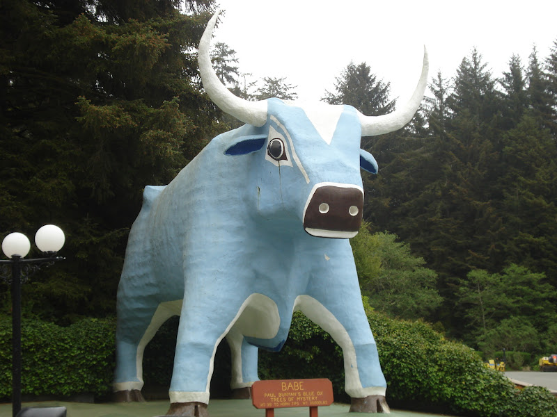
 On our 3rd day in Klamath, we drove north to Crescent City.  On our way we stopped at Trees of Mystery and walked the one mile path into the redwoods. Near the entrance are giant statues of Paul Bunyan and Babe, his blue ox.   Paul was getting cleaned up while we were there. There was a tree called the Family Tree, which was one tree whose branches grew out vertically and then, 12 branches grew horizontally into 12 more trees! Strange but true.  We saw a group of 9 redwoods, all next to each other in a half circle that they call the Cathedral Tree.  Many weddings are held there.  We also road the gondola to the top of the mountain, but due to low clouds (fog) we could see nothing below.  At Crescent City we had lunch, did our grocery shopping and stopped by the local lighthouse.

                                                                   
A message to our family & friends
               
Cathedral Tree
Spy Trail Gondola
Crescent City Lighthouse
On day 4 at Klamath, California, we took a ride across the the border into Oregon.  We drove along the coast highway, US 101 to Brookings and Gold Beach.  We had a nice lunch at the Porthole in Gold Beach and drove back along the coast.  Lots of beaches and a rocky shoreline.  Tomorrow is our last day here, and we are just staying at the campground and relax.  Next we are on to north central California and Mt. Shasta and Shasta Lake.

Oregon Coast near Brookings
Oregon Coast near Gold Beach
Debbie relaxing by the Klamath River